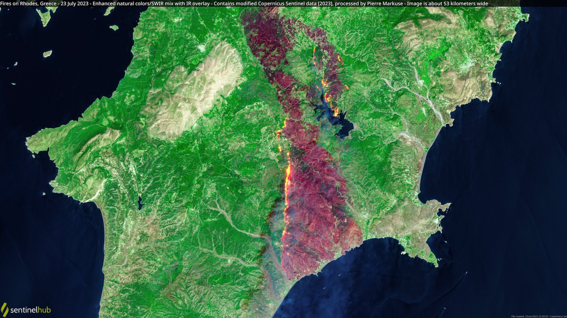
Πολλές εταιρείες και υπηρεσίες που διαθέτουν δορυφόρους στο Διάστημα τους έχουν στρέψει τις τελευταίες μέρες στην Ελλάδα καταγράφοντας εικόνες από τις καταστροφικές πυρκαγιές που έχουν ξεσπάσει στη χώρα μας.
Το ευρωπαϊκό πρόγραμμα Copernicus έδωσε στη δημοσιότητα εικόνες από την πυρκαγιά στην Εύβοια.
#Wildfires are blazing through various parts of Greece, including the islands of Corfu, Rhodes and Evia 🔥
— Copernicus EU (@CopernicusEU) July 25, 2023
Yesterday, a fire spread in Evia and locals and tourists have been evacuated
This #Sentinel2🇪🇺🛰️ image from 24 July shows fire sweeping across the south of the island pic.twitter.com/4sfJ3J6P7w
Βίντεο με δορυφορικές εικόνες από την πυρκαγιά στη Ρόδο.
The catastrophic fires in #Rhodes are clearly visible from space here, as #MTGI1 observed their resulting large smoke plumes on Saturday.
— EUMETSAT (@eumetsat) July 24, 2023
Please note: this is preliminary commissioning data. pic.twitter.com/fY9aJAiWUq
Κοντινές λήψεις εικόνων από την πυρκαγιά στη Ρόδο από το ευρωπαϊκό δορυφορικό πρόγραμμα Copernicus.
A close-up view of #Ροδος🇬🇷 #Rhodes in #Greece🇬🇷
— Copernicus EU (@CopernicusEU) July 25, 2023
Yesterday, #Copernicus #Sentinel3🇪🇺🛰️captured this false-colour image of the island, with the burn scar visible in brown
According to @CopernicusEMS' latest delineation map, an area of 13,312 ha has burned pic.twitter.com/NYo9OUr12x
Άλλη μια εικόνα από την φωτιά στη Ρόδο από τον Ευρωπαϊκό Οργανισμό Διαστήματος

